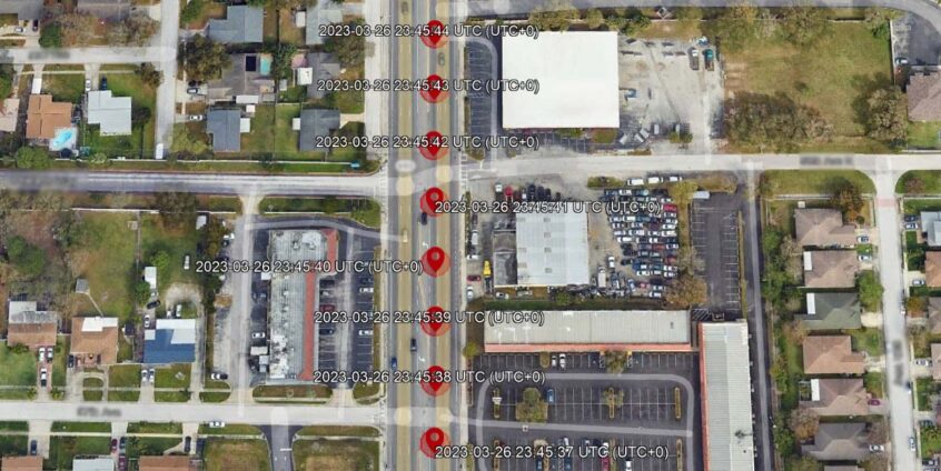
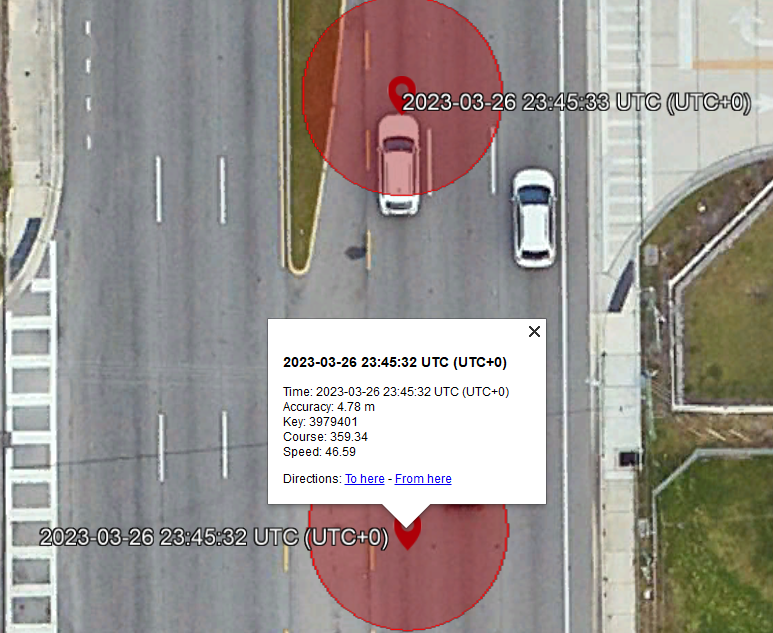
In digital forensics and investigative work, location data often plays a critical role in reconstructing events. GPS logs can contain thousands of entries, and visualizing this data in a clear, meaningful way is essential. One difficulty I encountered during digital forensic investigations — for example, when working with the Apple iOS cache.sqlite database — was that most paid forensic tools were unable to properly map the standard GPS data stored within. This database often contains additional columns such as GPS point accuracy, speed, and course/direction. However, many of the large-scale forensic and mapping tools I had access to — despite costing thousands of dollars — did not display the accuracy radius, which is crucial in evaluating location precision. The one tool that did display the accuracy radius failed to incorporate the other important columns, which are often vital in cases such as traffic homicide investigations where speed and course can be critical.
To help streamline this process, I developed a tool that converts CSV or Excel GPS datasets into Google Earth-compatible KMZ files. The result is an interactive map that investigators can use to analyze movements, verify timelines, and present findings with greater context.
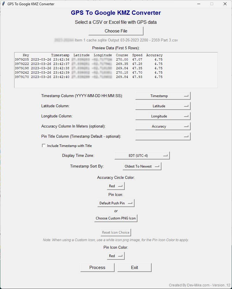
This tool was designed with practical investigative needs in mind. It supports timestamp parsing and allows the user to sort data chronologically (oldest to newest or newest to oldest). Time zone adjustments are also built in, making it easier to normalize data collected across different regions. Flexible customization options let investigators choose map marker styles, pin colors, and accuracy circles, ensuring the visualization is tailored for clarity during analysis or courtroom presentation. Additionally, data columns such as latitude, longitude, timestamp, accuracy, and custom titles can all be mapped directly through the interface, providing compatibility with a wide range of data sources.
The program was built in Python and packaged into a Windows application, so end users do not need to run scripts or install Python themselves. The GPS to KMZ Conversion Tool leverages Python libraries including Pandas, SimpleKML, OS, Tkinter, Math, and Datetime to provide both functionality and ease of use.
The goal was to create a lightweight, user-friendly solution that reduces the friction between raw GPS data and actionable insights. By bridging this gap, analysts and forensic examiners can spend less time preparing data and more time uncovering the story that the data reveals.
Key Features
- CSV/Excel Support – Works with both CSV and Excel GPS datasets.
- Custom Column Mapping – Map latitude, longitude, timestamps, accuracy, and custom titles.
- Timestamp Handling – Supports sorting (oldest-to-newest or newest-to-oldest) and time zone adjustments.
- Map Marker Customization – Choose pin icons, colors, and accuracy circle overlays.
- Preview Function – View the first five rows of your dataset before processing.
- User-Friendly GUI – Simple interface for quick and efficient conversion.
- Map Pin Title Select – Select which column to display on the map next to the marker.