DFIR Utility
GPS Data CSV To Google Map KMZ Converter
Overview
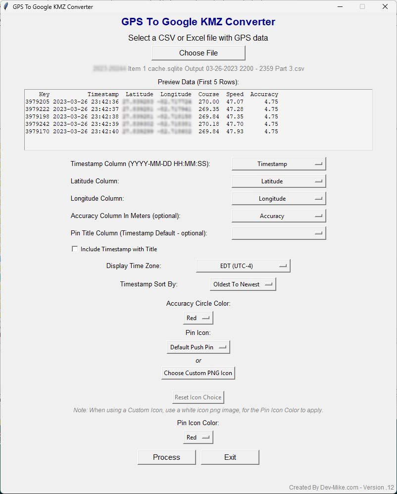
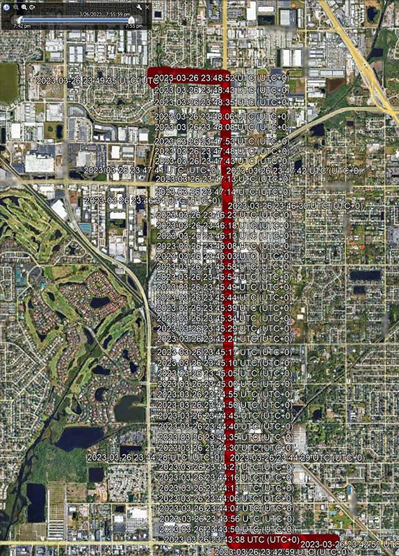
This Python-based GPS to Google KMZ Converter is a graphical tool designed to simplify the process of visualizing large sets of geolocation data. It converts CSV or Excel files containing GPS coordinates into Google Earth-compatible KMZ files. With a modern and customizable GUI, digital forensic analysts, investigators, or open-source intelligence professionals can quickly map and review location-based evidence. The tool also supports timestamp sorting and visual customization for easier data interpretation.
Description
The GPS to Google KMZ Converter is a forensic utility built in Python that allows investigators to rapidly transform GPS data from CSV or Excel files into KMZ files compatible with Google Earth. This tool was developed with digital forensic professionals in mind, providing a clean, intuitive graphical user interface (GUI) that requires no scripting or command-line experience. The converter supports full column mapping for essential GPS data fields including timestamps, latitude, longitude, accuracy, and optional pin titles. A built-in preview pane gives users the ability to inspect the first few rows of their dataset to confirm the structure before processing.One of the key strengths of this tool is its flexibility with timestamp data. Users can choose the display time zone and sort records chronologically, either from oldest to newest or vice versa. To further support large-scale investigations involving thousands of GPS points, the tool includes an optional "Split Row to New Files" feature, which breaks the dataset into multiple KMZ files based on row count — extremely useful for managing performance in Google Earth and separating data by temporal or logical segments. The resulting KMZ files are automatically labeled with their corresponding row groupings (e.g., MyMap_Rows500.kmz).
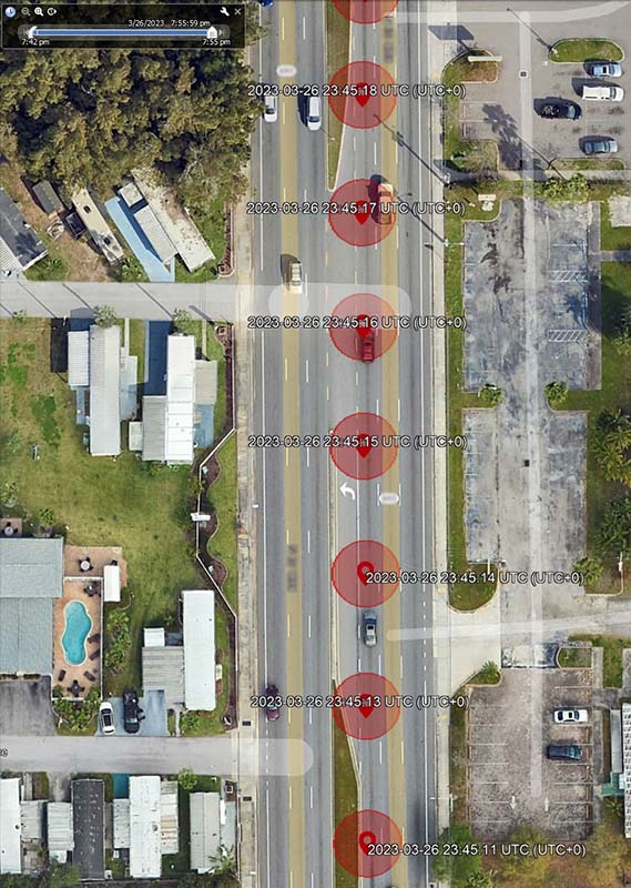
Visual customization is another core feature. Analysts can assign color-coded accuracy circles, apply custom pin icons (with real-time previews), or choose from a list of default Google Earth icon styles. Additionally, there's an option to apply color overlays to the pins or leave them uncolored when a neutral look is preferred. The tool also supports timestamp overlays on pin titles, allowing for faster chronological correlation during map reviews. Whether you are investigating mobile phone location data, vehicle telematics, or IoT logs, this application streamlines the process of converting raw coordinates into a visually intuitive geospatial narrative.
This utility is ideal for digital forensics, threat intelligence, OSINT research, or any investigative workflow where timeline-based geolocation mapping is critical.
Disclaimer
This tool is provided “as-is” without any warranty, express or implied. While it has been developed with care and tested on real-world datasets, users are responsible for validating results before relying on them in investigative, legal, or professional contexts. The author assumes no liability for any errors, omissions, or consequences that may arise from the use of this software. Always cross-check findings with validated forensic methods and tools where appropriate.
Open Source & Licensing
This tool is released under the GNU General Public License (GPL) and is free for anyone to use, modify, and distribute. Investigators, researchers, students, and hobbyists alike are encouraged to adapt the program to their needs, whether for professional casework, academic study, or personal projects. By keeping it open source, the goal is to ensure that powerful and practical tools for working with GPS data remain accessible to the entire community without the barriers of licensing fees or vendor restrictions.
Technologies
– Python
– Google Earth
Contact
Dev Mike.
Contact Now


